
A world-famous tourist resort north of Agios Nikolaos, with lacy, windless sandy beaches, crystal clear…
Vrouchas-Aforesmenos Lighthouse
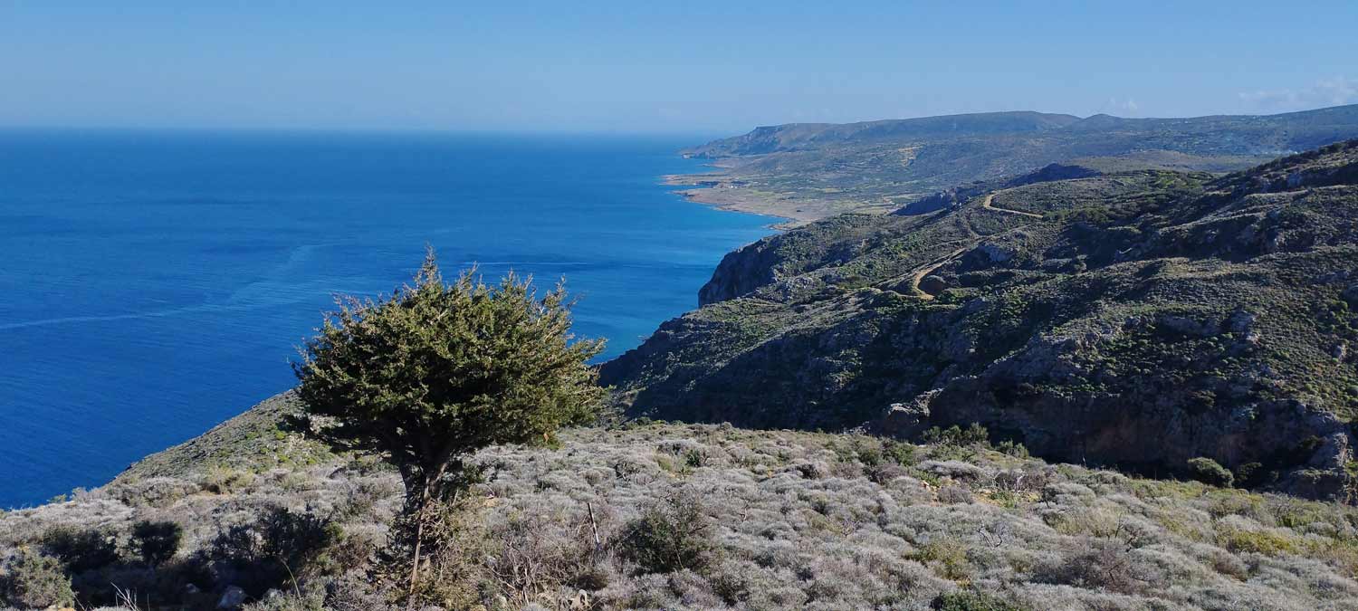
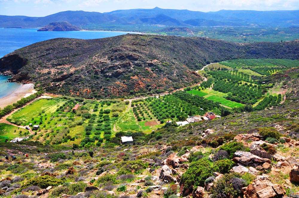
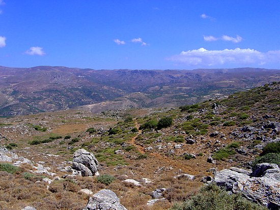
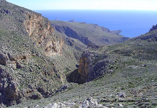
From the village of Vrouchas we drive downhill on a narrow cement road at the beginning between cultivated fields, enjoying the impressive view of the sea. As we approach the northern coastline the landscape changes and the olive groves thin out, giving way to barren, uncultivated areas, with low bushes battered by the constant meltemi winds. Halfway through the route we pass by the chapel of Agios Artemios and 2 km further we meet the coastal dirt road to the sea and we pass over the rocky shores of Agios Dionysios, another chapel, deserted and abandoned shores in the fury of the waves.
We turn east (right) and continue on the passable dirt road for another 1 km until the road stops and from this point it continues as a clearly visible and easy path since we are invited to walk parallel to the coast and without any changes in altitude. The wild beauty of the landscape is impressive, as we have on our right gray bare rocks that the salt and the wind have sculpted into strange shapes and on our left the immense blue of the Aegean.
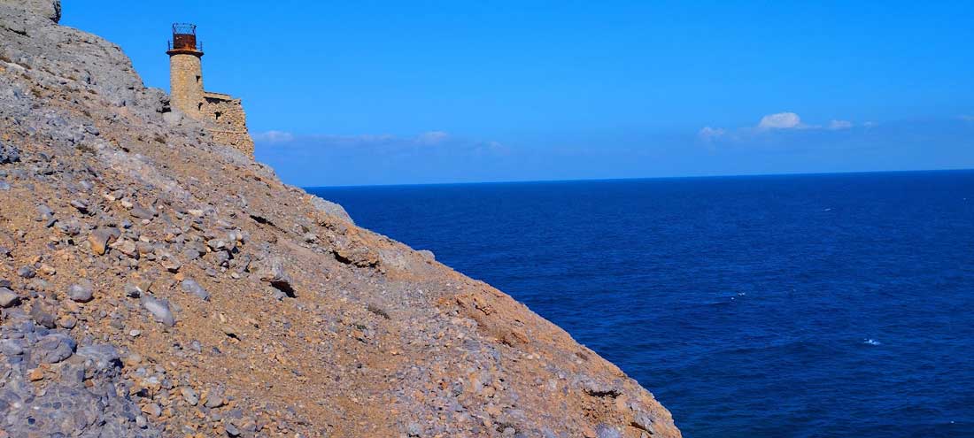
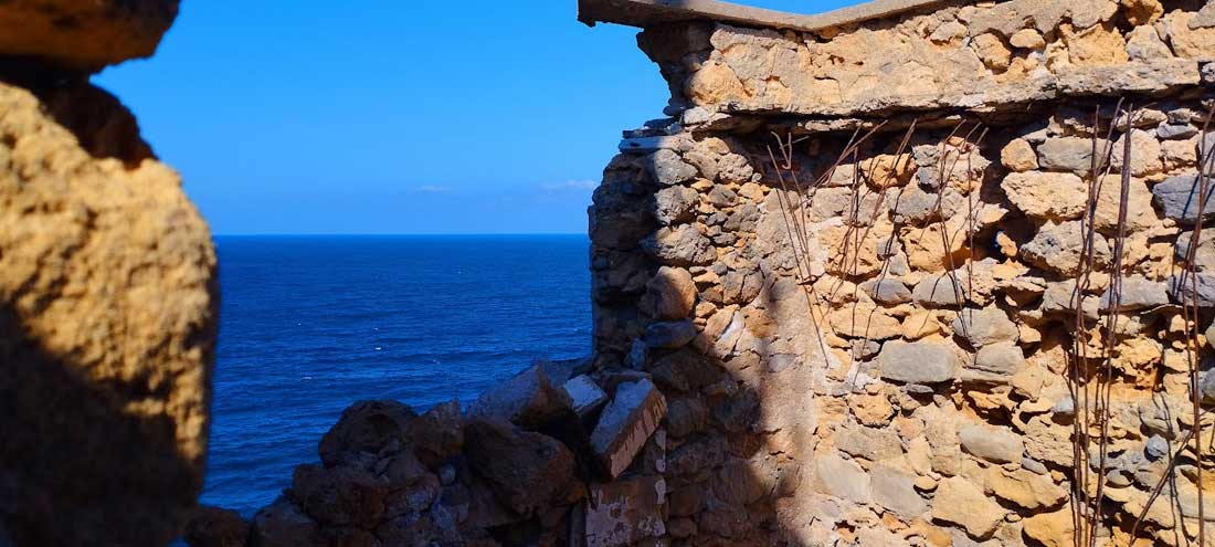
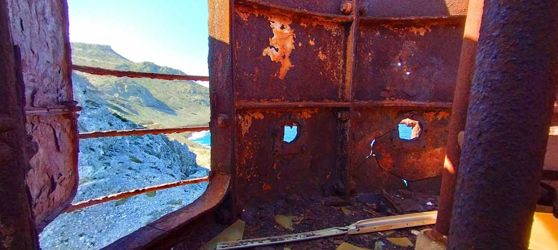
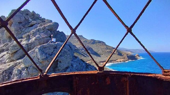
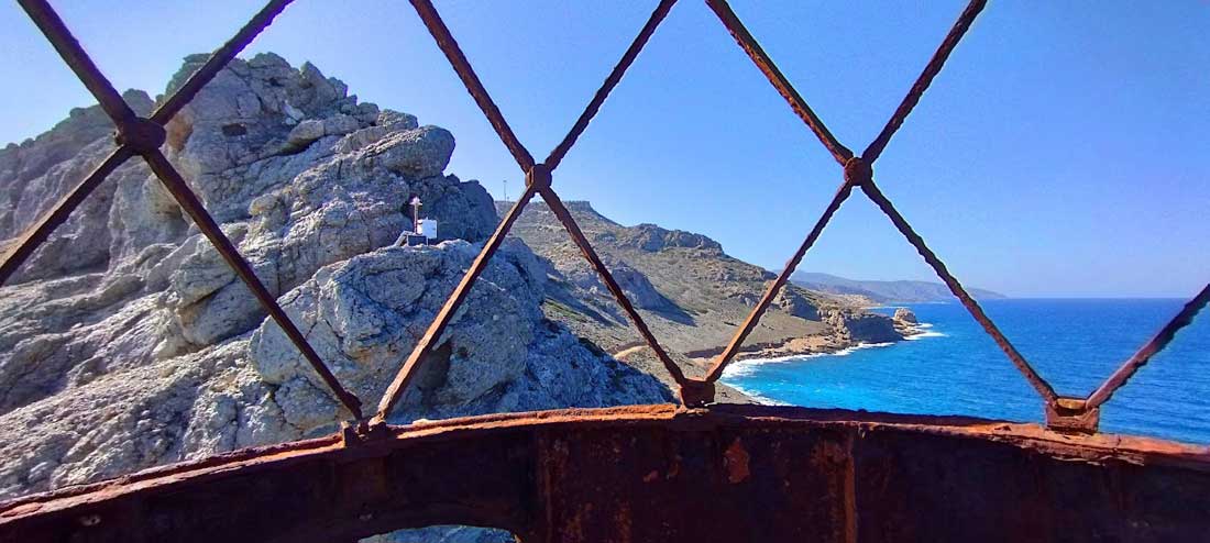
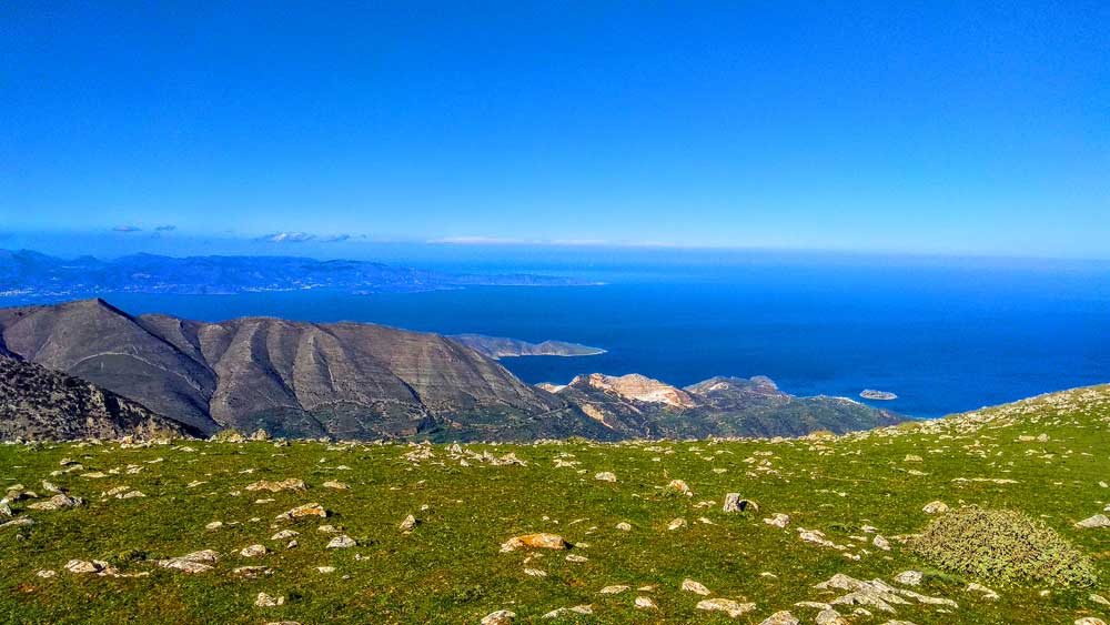
We continue always along the coast and from afar we can see the old lighthouse, built on the cape of Agios Ioannis, and very soon we are there since the distances are short and covered quickly. A little further on, about 1 km before the lighthouse, we can see on the top of the rock a ruined tower, a remnant of the Venetian rule.
Read about the history of the Aforesmenos Lighthouse
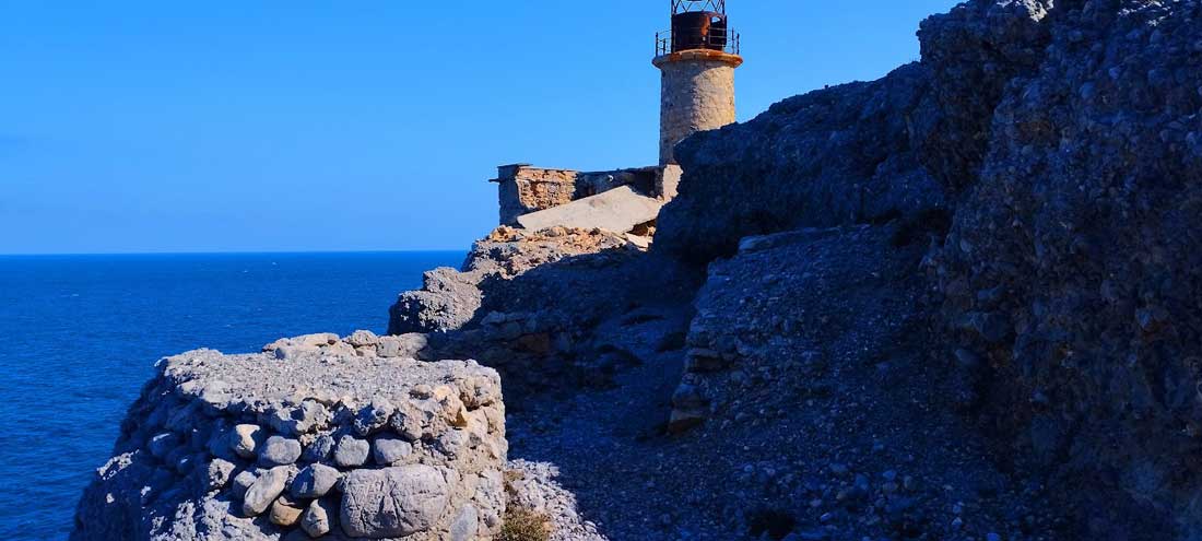
The lighthouse of Aforesmenos
The lighthouse of Aforesmenos is located 27km north of Agios Nikolaos, 20km from Elounda, and near the village of Vroucha. It was built on the cape of…
After the lighthouse we continue on the spectacular, narrow and steep path that crosses the cape of Agios Ioannis which unfolds several meters above the calm sea where immediately after we pass over the small sheltered bay of “Chomatistra”, a refuge for the fishermen of the area. On the hillside, above the path, there are large rocks, quite high above sea level, covered with fossilized shells, testifying to a unique geological phenomenon and a completely different relief of the area.
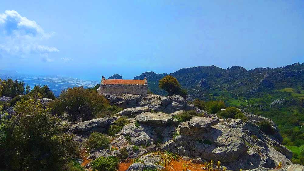
From afar we see the towering wind turbines emerging incongruously on the ridge. The uphill course now makes our steps difficult, covering an altitude difference of 240m in a distance of approximately 1.5 km and we always walk on the path that runs parallel to the dirt road towards the small plateau that is located at the highest point of the area. We pass near the German machine gun and the open tunnels that one can explore and are sad remnants of the last great war, and we arrive at the Agios Ioannis wind farm.
Additional Info
Altitude: Lowest point : 5m (Dirt road on the sea) – Highest point: 250m Agios Ioannis chapel at the wind park
Starting Point: Vrouchas Village 11 km north of Elounda
Path Type: At the beginning dirt road – After on clearly visible coastal path. The last part mixed road and trail
Difficulty: Moderate
Walk distance: 9 km : 3 – 3,5 hours
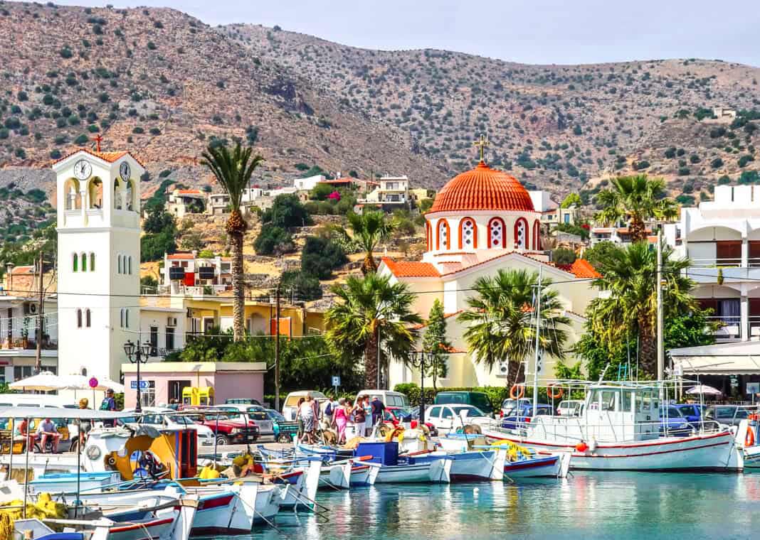
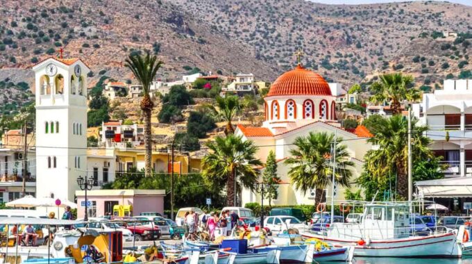
Elounda
A world-famous tourist resort north of Agios Nikolaos, with lacy, windless sandy beaches, crystal clear…
Kolokitha Peninsula, circular path
We leave our vehicle at the parking lot next to the Venetian windmills and near…

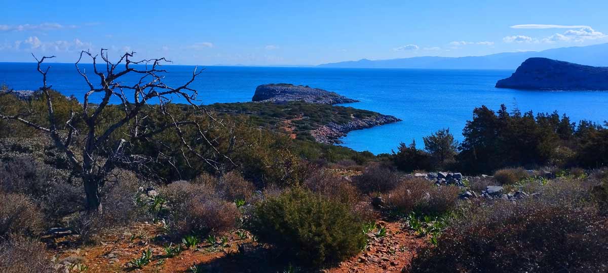
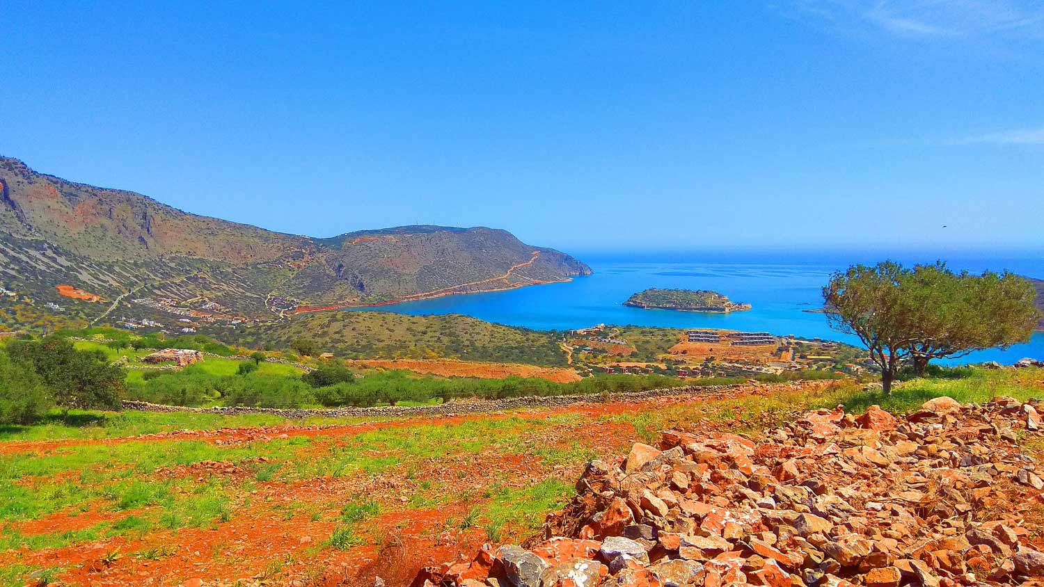
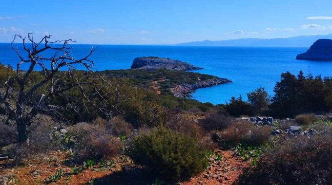
The island of Kolokitha, Elounda
The island of Kolokytha or Vryonisi is located in the Gulf of Mirabello opposite the…
The lighthouse of Aforesmenos
The lighthouse of Aforesmenos is located 27km north of Agios Nikolaos, 20km from Elounda, and…
Vrouchas-Aforesmenos Lighthouse
From the village of Vrouchas we drive downhill on a narrow cement road at the…
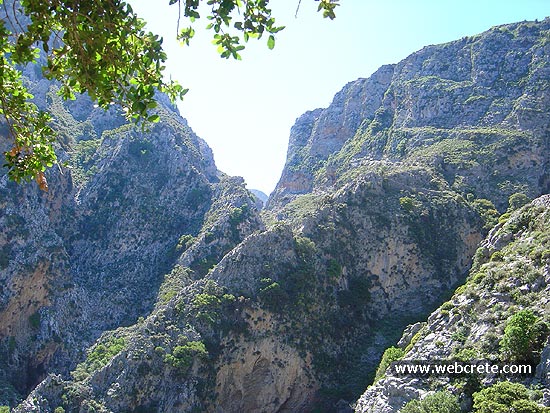
Skotini Gorge, Finokalia
A relatively small but impressive gorge with many changes in its landscape is the unknown…
Havgas Gorge, Elounda
We start from Elounda village by car and head west towards the village of Pines.…
Kritsa
Kritsa is one of the oldest and most picturesque villages in Crete, Greece, built amphitheatrically…
Sitia Geopark
The Natural Park of Sitia is on the easternmost edge of Crete, in the Municipality of Sitia. It covers the…
At the coastal region south of Palm Beach Vai, the nature hides some treasures almost…
We leave our vehicle at the parking lot next to the Venetian windmills and near…
The small plateau of Monokara is located on Mount Ornos, at an altitude of approximately…
The route "Kalamafka - Meteora Crete - Holy Cross - Kalamafka" is an easy hiking…
Today the ascent was made from the Omalos Plateau of Viannos which is at an…
This route which we recommend is one of the most exciting hikes in eastern Crete…
The point that you are to start trekking to the Katofigi cave, is about 200…
The island of Kolokytha or Vryonisi is located in the Gulf of Mirabello opposite the…
Related Articles
This Post Has 0 Comments